 Have you picked up a copy of the latest edition of the Kansas Bicycle Map?
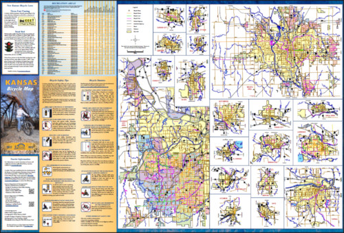
This free publication from the Kansas Department of Transportation features a detailed map of the state showing suggested cross-state bicycle routes, including the TransAmerica Trail and the American Discovery Trail, as well as national and state scenic byways.
One of the most useful features of the map are the highway traffic counts and shoulder information. The map shows whether roads are two-lane or multi-lane, and whether they include shoulders or not. Roads are also color-coded to denote traffic volume: red is “high” (more than 3000 vehicles per day), green is “moderate” (1000-3000), and orange is “low” (less than 1000). There are also quite a few unpaved county roads shown on the map, which provide extremely low-traffic routing options.
In addition, there are mileage markers so you can see how far it is between towns or turns, and town size and state parks are also denoted. The map even highlights cities with bicycle shops.
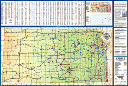
And finally, the first page of the map includes a directory of cities and counties, plus a map locating Kansas Rail-Trails
The other side of the map provides a list of list of state parks and the amenities each supplies, an overview of Kansas Cycling Laws and bicycle safety tips, plus detail maps of selected Kansas communities showing bicycle routes, bike lanes, and bike paths.
Of special note is that the map highlights the news bicycling-related laws that went into effect last year: the 3-Foot Passing Law, which requires that vehicles pass bicycles with at least three feet of clearance, and the Dead Red Law, which allows bicyclists and motorcylists to legally proceed through inoperative red lights in Kansas when it’s safe to do so.
You can view the Kansas Bicycle Map online (PDF) or order a free hard copy by emailing your request to BikePed@ksdot.org . Please include your name and mailing address in the request. The guide is also available at many public libraries and government offices.
Thanks to Bicycle and Pedestrian Coordinator Becky Pepper and the KDOT staff for putting the Kansas Bicycle Map together. This is a great resource for both Kansas residents and visitors — get your copy today!
Post tags: NewsBlog