
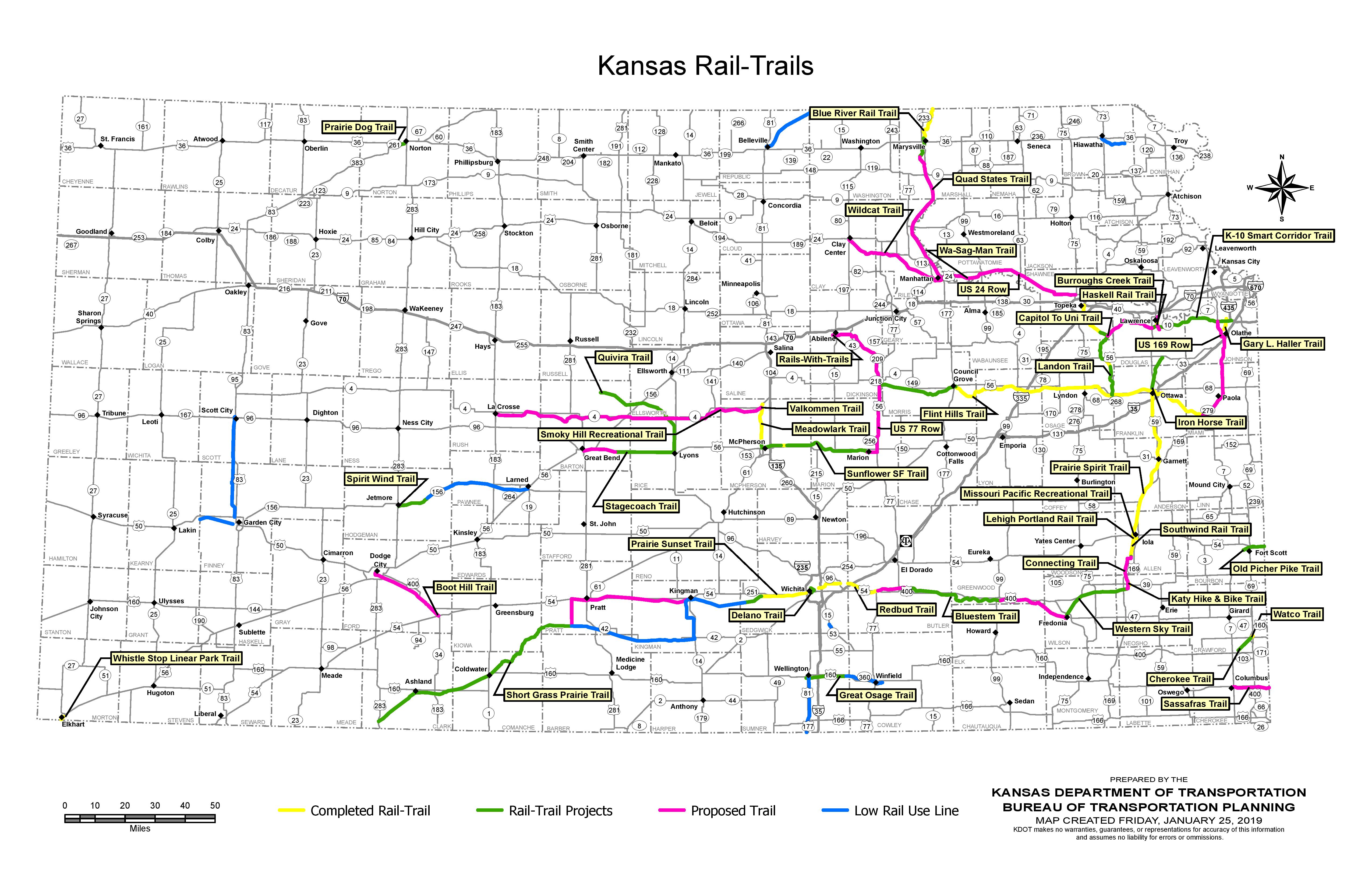
This is an updated 2019 version of the Kansas Rails-to-Trails Map that was originally included with the 2013 Kansas Statewide Rail-to-Trails Plan.
The map was updated by KDOT cartographer Elaine Bryant, in consultation with the Sunflower Rail-Trails Conservancy. It is also available as a PDF.
Since the last update, some trails have moved from “projects” to “completed”, while others have gone from “proposed” to “projects”, while new proposed trails have been added, and a few dormant trail concepts have been dropped entirely.
As always, the state of the Kansas rail-trail network is always changing, always growing. There is significant momentum for rail-trail development in Kansas!
Post tags: Rail Trail


Exciting to see what were Proposed Trails on the previous maps turn in to Projects on this one. Super excited for the one connecting KC to the FHNT and for the one from Clay Center through MHK to Topeka.
Any info on that “K-10 Smart Corridor Trail”? That’s been on the map for a while, but I haven’t seen much about it.
Nope, no additional info on the K-10 Trail. It’s still being planned for, and the assumption is that it’ll happen at some point, but as far as I know it’s not imminent…