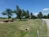
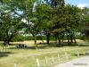
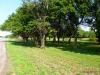
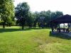
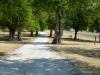
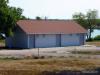
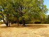
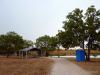
2012 Kansas Cycling Photos

Photos From 2012
Trail Head Park in Pittsburg, Kansas - Watco Trail is a paved rail-trail in Pittsburg, Kansas that begins at Trail Head Park at 11th and Broadway in downtown Pittsburg. Watco Trail in Pittsburg, Kansas - Watco Trail runs diagonal to the street grid, so there are over 20 road crossings along the route, each one with bollards and signs. Yield to any on-street traffic. Trail Head Park Placard - The Watco Trail and Trail Head Park were made possible through the generosity of these organizations and volunteers. Roger Lomshek - This is Roger Lomshek, who owns Tailwind Cyclists in Pittsburg, KS. Roger also organizes the annual Gorilla Century and the Kansas Road Race Championships (criterium, time trial, road race) in and around Pittsburg, and takes the lead on a number of trail-building projects in southeast Kansas. Thanks for all you do to promote cycling, Roger! Cooky's Cafe: Pie Heaven - Cooky's Cafe in Golden City, Missouri is reputed to have the best pie on the TransAmerica Bicycle Trail. No argument from here. Awesome eats!
SAG Spread - A table full of strawberries, grapes, bananas, and other goodies await cyclists on the Kansas City Metro Bicycle Club's annual Spring Classic bicycle ride near Olathe, KS. Olathe Bike Lane - A cyclist pedals along 143rd Street (Dennis Avenue) in Olathe, KS. Bike-In Movie - The Boulevard Drive-In Theatre in Kansas City, Kansas was a 'Bike-In' for one night during 2012 Kansas City Bike Week festivities. Showing this night was the classic bicycle racing movie 'Breaking Away'. US-54 Rosalia Roadside Park - This is a view of eastern end of the Rosalia Roadside Park, showing a small picnic shelter, cement picnic tables, a grill, and shade trees. US-54 Rosalia Roadside Park - This is a view of the Rosalia Roadside Park from the turnout road. It shows picnic tables, trash cans, fire pits, an information kiosk, and non-functioning water fountains.
US-54 Rosalia Roadside Park - This is a view of eastern end of the Rosalia Roadside Park, showing shade trees, grass for picnicking or camping, and a cement picnic table. US-54 Toronto Roadside Park - Trees and Shade - This is a view from the west end of the roadside park, showing the wealth of grass and shade trees for picnicking or camping. US-54 Toronto Roadside Park - Restrooms - The roadside park contains a modern restroom facility, with maps, brochures, and water fountains. US-54 Toronto Roadside Park - Picnic Shelter - Looking towards the west, with the picnic shelter and picnic tables in the foreground, and grass and trees for camping beyond. US-54 Toronto Roadside Park - Historical Marker - Kansas Historical Marker:
Neosho Falls Riverside Park - Entrance - This is entrance to Riverside Park. The left column reads Neosho Falls Riverside Park - Fees - A sign showing the camping fees at Riverside Park. A family has set up their tent among the trees in the background. Neosho Falls Riverside Park - Picnic Shelter - A view of the trees and grass at Riverside Park, with picnic tables and a picnic shelter. Neosho Falls Riverside Park - Restrooms - Not the most modern restroom facilities, but they appear to be relatively clean and well-kept. There is also a water hydrant (not sure if the water is potable or not). Neosho Falls Riverside Park - Picnic Tables - This photo shows some of the picnic tables and fireplaces, with playground equipment in the background.
Antioch Park - The view from the pedestrian boardwalk on South Lake at Antioch Park. US-56 Baldwin City Roadside Park Historical Marker - This is the historical marker at the Baldwin City Roadside Park, which tells the story of the Battle of Black Jack, which took place here in 1856, and which is considered by many to have been the first battle of the American Civil War. US-56 Baldwin City Roadside Park Markers - These markers have been placed at the Baldwin City Roadside Park. The stone marker was placed, in 1906, by the Daughters of the American Revolution to mark the Santa Fe Trail. The green sign was erected in 1984, and explains the history of Black Jack Park. US-56 Baldwin City Roadside Park - Ivan Boyd Prairie Preserve - At the southern edge of the Baldwin City Roadside Park is a footbridge and nature trail leading to the Ivan Boyd Prairie Preserve, which contains native, virgin tallgrass prairie, along with some well-preserved ruts from the old Santa Fe Trail. US-56 Baldwin City Roadside Park - Santa Fe Trail Ruts - Just south of the Baldwin City Roadside Park is the Ivan Boyd Prairie Preserve, which contains some well-preserved ruts from the old Santa Fe Trail. They're difficult to see from the road, but if you takes the nature trail from the park, they are readily apparent.
US-56 Baldwin City Roadside Park - Battle of Black Jack Park - Just south of the Baldwin City Roadside Park is the Robert Hall Pearson Battle of Black Jack Memorial Park, which commemorates what many consider to have been the first battle of the American Civil War. The park has picnic tables, but no other amenities, and does not allow camping. US-56 Baldwin City Roadside Park - A view of the Baldwin City Roadside Park, showing the gravel loop road, the replica log cabin, and the shaded grassy area for picnicking or camping. Douglas State Fishing Lake - Bicycle Camping - A bicycle and tent beneath a Cottonwood tree along the shores of Douglas State Fishing Lake.  Primitive camping is free at designated areas along the west side of the lake. Douglas State Fishing Lake - Pier - A bicycle on an earthen pier at Douglas State Fishing Lake, which boasts scenic, timbered shores, as well as ample areas for shoreline fishing, camping, and picnicking. Douglas State Fishing Lake - Sunrise - A fishing boat on the water shortly after sunrise at Douglas State Fishing Lake.
Douglas State Fishing Lake - Wildflowers - Wildflowers bloom in profusion at Douglas State Fishing Lake. Here are some signs, as well as a view of one of the restroom facilities in the background. Douglas State Fishing Lake - Restroom - This is a look at the clean, well-maintained ADA-compliant vault toilets at Douglas State Fishing Lake. There are a total of four similar facilities at the lake. Louisburg Middle Creek State Fishing Lake - Entrance Sign - This is the entrance sign at Louisburg Middle Creek State Fishing Lake, showing rules and regulations for the lake. Louisburg Middle Creek State Fishing Lake - Campsite - A typical campsite at Louisburg Middle Creek State Fishing Lake, with a fire ring, picnic tables, grass, and some shade trees. There are approximately ten such sites available on the north shore of the lake. Louisburg Middle Creek State Fishing Lake - Restrooms - Louisburg Middle Creek State Fishing Lake has nearly new restroom facilities, with ADA-compliant pit toilets. However, there is no electricity or running water available at the lake.
La Cygne Wildlife Area - Campsites - This area along La Cygne Lake is available for primitive camping. There are no amenities -- no picnic tables, no fire rings, no water, and no electricity. La Cygne Wildlife Area - Restroom - There is a single restroom available near the primitive camping area at La Cygne Wildlife Area. It is a pit toilet, but there is no water, and no electricity (despite the automatic lamp shown). La Cygne Wildlife Area - Bridge - This historic bridge over La Cygne Lake on the La Cygne Wildlife Area was built in 1962. All roads leading to and from this camping area are gravel. Gunn Park - Map - This sign at the entrance to Gunn Park shows a map of the park. The tent camping area is in RV Park/Camping area in the center of the park. Gunn Park - Info Sign - This sign provides information about Gunn Park. As it states, tent camping is $4 per night, can can be paid at city hall, or to the park caretaker. There is also a self-pay kiosk near the campground.
Gunn Park - Self-Pay Kiosk - To pay for your stay at Gunn Park, grab an envelope from the appropriate box, fill in your contact details, include your payment, and put the envelope in the lock box. Tent camping is $4 per night. Pleasanton East City Lake - Sign - This sign specifies the regulations in place at Pleasanton East City Lake, primarily in regards to fishing limits. Pleasanton East City Lake - North Shore - This is a typical camping and picnicking area on the northern shore of the lake. Picnic tables, trash cans, and portable toilets (not shown) are provided. Pleasanton East City Lake - South Shore - This is a typical camping and picnicking area on the southern shore of the lake. Picnic tables, trash cans, and portable toilets (not shown) are provided. Pleasanton West City Lake - Designated Camping Area - This is the designated camping area at the Pleasanton West City Lakes.
Pleasanton West City Lake - No Camping In Shelter House Area - Camping is prohibited near the shelter houses at the Pleasanton West City Lakes; please use the designated camping area provided. Pleasanton West City Lake - Restroom - This is a typical restroom at the Pleasanton West City Lakes. Prescott City Lake - Entrance Sign - This is the entrance sign to Prescott City Lake, with the lake and picnic shelter visible in the background. Prescott City Lake - Shelter - This is the picnic shelter at Prescott City Lake, with picnic tables, a trash can, and a stone hearth in the foreground, and the restrooms in the background. No water or electricity is available. Gunn Park - Designated Tent Camping Area - This is the designated tent camping area at Gunn Park. There is one picnic table, and a water hydrant, as well as nearby restrooms. Cost is $4 per night.
Gunn Park - Restrooms - These are the restrooms at Gunn Park. Facilities include flush toilets and sinks. No showers. The restrooms are located just behind the RV campsites, and a couple hundred feet from the tent camping area. Lake Fort Scott - Entrance Sign - This sign is located at the entrance to Lake For Scott, and shows the services and facilities provided: boating, fishing, swimming, and camping. Lake Fort Scott - Designated Camping Area - This sign identifies the Designated Camping Area at Lake Fort Scott. Camping at the lake is allowed only in this area. The lake, picnic shelter, and restrooms are shown in the background. Lake Fort Scott - Regulations - This sign, affixed to the picnic shelter, details the rules and regulations in the camping area at Lake Fort Scott. The cost for camping is $5 per night, paid on the honor system via self-pay envelopes and a lock-box (located in the shelter). Lake Fort Scott - Campsite - This is a campsite at Lake Fort Scott, showing a picnic table and trash can. Campsites near the water are rocky and uneven, while sites farther from the water are generally flatter and grass-covered.
Elm Creek Lake - Entrance Sign - The entrance sign at Elm Creek Lake provides information about facilities at the lake, as well as the rules and regulations governing the property. Elm Creek Lake - Lake View - This is a view of Elm Creek Lake from the road across the dam. There is limited shade around the lake, but ample grassy areas for tent camping. Elm Creek Lake - Shelter House - This is a photo of one of the historic shelter houses at Elm Creek Lake, built by the WPA (Works Progress Administration) from native stone in the 1930s. Camping is not permitted near the shelter houses, which are available for rent. Rock Creek Lake - Camping Area - This is one of the camping areas at Rock Creek Lake, showing grass, shade trees, and easy access to the water. Rock Creek Lake - Signage - These signs at Rock Creek Lake show the fishing regulations, as well as the 4-day camping limit in place at the lake.
Rock Creek Lake - Rock Ledge - This photograph shows a touring bicycle perched on a rocky ledge on the shore of Rock Creek Lake. Not a great place to pitch a tent, but a wonderful spot to fish or simply watch the water... Miami State Fishing Lake - Entrance - This the view from the entrance road to Miami State Fishing Lake. Camping ahead! Miami State Fishing Lake - Campsite - This is one of the campsites at Miami State Fishing Lake, with fire ring. There are thirteen earthen piers extending into the lake, each wide and long enough for several tents. Miami State Fishing Lake - Restrooms - These are the restroom facilities at Miami State Fishing Lake. There are pit toilets, but no running water or electricity. Lake Miola - Entrance Sign - This sign is located at the entrance to the camping area at Lake Miola. It details the camping fees ($12/night for non-residents), and some of the rules and regulations for the campground.
Lake Miola - Camping Area - This is one of the camping areas at Lake Miola. There are picnic tables, fire rings, grassy areas, and shade trees. Lake Miola - Shower House - This is the restroom/showerhouse at Lake Miola. Inside, there are several shower stalls, a sink and mirror, and flush toilets. Richmond City Lake - Typical Campsite - This is a typical campsite at Richmond City Lake. It offers a trash can and fire ring, but no other services -- no picnic table, no restroom, no drinking water. Franklin County Visitor Information Center - Camping Area - This is the camping area located behind the Franklin County Visitor Information Center in Ottawa, Kansas. A picnic table is provided, but there are no other amenities. Restrooms and other services are available at nearby convenience stores. Franklin County Visitor Information Center - The Franklin County Visitor Information Center is located on the eastern edge of Ottawa, Kansas, on the north side of K-68 Highway, about 1/2 mile west of I-35. The center provides a wealth of information about attractions and points of interest in the area.
Richmond City Lake - Tent Campsite - This is a typical primitive campsite at Richmond City Lake, with a tent and bicycle. Note that this photo was taken during a very dry period, so the lake water level was very low, and all the grass was dry. Richmond City Lake - Shelter - This photo shows one of the shelters at Richmond City Lake, along with a porta-potty, picnic tables, and grill. There is no drinking water or electricity available. Leavenworth State Fishing Lake - Entrance Sign - This is the entrance sign at the eastern end of Leavenworth State Fishing Lake. The entrance road is paved on the east end of the lake; gravel on the western end. Leavenworth State Fishing Lake - The Lake - A view of the water at Leavenworth State Fishing Lake. Sadly, camping is prohibited in the area visible along the right edge of this photo, but it's a great place to fish. Leavenworth State Fishing Lake - Campground - This is a typical primitive camping area at Leavenworth State Fishing Lake. There are four campgrounds at the lake -- one on the eastern shore, two along the western shores, and this one, on a ridge south of the lake. This campground offers a shelter, picnic tables, fire rings, a pit toilet, and ample flat shaded grassy ground for setting up a tent. There is no drinking water or electricity available.
Leavenworth State Fishing Lake - Restrooms - This is a typical restroom at Leavenworth State Fishing Lake. It is a single-stall unisex pit toilet, with no running water or electricity. Garnett North Lake Park - Sign - This is the entrance sign to North Lake Park in Garnett, Kansas. It lists the facilities at the lake, and specifies that camping is permitted in the camping area only. It also says that payment can be made at city hall or the police station. There is also a self-pay station at the campground. Garnett North Lake Park - Entrance - This is the entrance sign to the campground at North Lake Park in Garnett, Kansas, with a selection of campsites in the background. Garnett North Lake Park - Self-Pay Station - This is the Self-Pay Station in the campground at North Lake Park in Garnett, Kansas. The top box contains permits, which must be filled out (no pen provided) and deposited with the camping fee in the lower box. Garnett North Lake Park - Campground - This photo shows shows some of the campsites at North Lake Park in Garnett, Kansas. There are picnic tables, water and electricity, trash bins, a shelter, and grassy areas near the water.
Garnett Cedar Valley Reservoir - Entrance Sign - This is a entrance sign for Cedar Valley Reservoir near Garnett, Kansas. It includes rules and regulations for the lake (though you can't read them in this image). Garnett Cedar Valley Reservoir - Self-Pay Station - This is the Self-Pay Station in the campground at Cedar Valley Reservoir near Garnett, Kansas. The top box contains permits, which must be filled out (no pen provided) and deposited with the camping fee in the lower box. In the background is one of the restrooms (port-a-potties). Garnett Cedar Valley Reservoir - RV Campsites - These are some of the RV campsites at Cedar Valley Reservoir near Garnett, Kansas. Each includes electric hookups and a picnic table, with no water available. Tenters may camp here, or at one of the non-utility campsites nearer the lake. Garnett Cedar Valley Reservoir - Tent Campsites - This is a typical tent site at Cedar Valley Reservoir near Garnett, Kansas. It includes a picnic table and trash can. No electricity or water is available. Santa Fe Safari Campground - Sign - This signat the Santa Fe Safari Campground in Chanute, Kansas lists the rules and regulations for the campground.
Santa Fe Safari Campground - Restrooms - This is the restroom and shower facility at the Santa Fe Safari Campground in Chanute, Kansas. There are separate men's and women's facilities, each with a single-stall shower, flush toilet, and sink with running water. Santa Fe Safari Campground - Tent Area - This is the tent camping area at the Santa Fe Safari Campground in Chanute, Kansas. There is a picnic table, electricity, water, and ample grass for pitching a tent. Camp Hunter - Entrance Sign - This is the sign at the entrance to Camp Hunter Park in Humboldt, Kansas. It lists the rules and regulations at the park. Please note that there is no fee for tent camping, though visitors must still check in with the Police Department. Camp Hunter - Camping Area - This is a view of one of the tent camping areas at Camp Hunter Park in Humboldt, Kansas. There are picnic tables, trash bins, and electricity nearby, with plenty of grass and shade trees. Camp Hunter - Shelter House - Here is a view of the main shelter house at Camp Hunter Park in Humboldt, Kansas. There are nearby picnic tables, grills, electricity, and this handy bike rack!
Camp Hunter - Restrooms - This is the restroom and shower facility at Camp Hunter Park in Humboldt, Kansas, located on the east end of the park, near the camping areas and shelters. If the doors are locked (as they were on my visit), check with the police or a city employee. Pottawatomie State Fishing Lake No. 2 - Entrance Sign - This is the entrance sign for Pottawatomie State Fishing Lake No. 2, located just a few miles northeast of Manhattan, Kansas. The lake is located in a beautiful and rugged section of the northern Flint Hills. Pottawatomie State Fishing Lake No. 2 - Campsite - This is a typical campsite at Pottawatomie State Fishing Lake No. 2, which includes a picnic table, fire ring, shade trees, and easy lake access. Pottawatomie State Fishing Lake No. 2 - Campground - This is a look at one of the campground areas at Pottawatomie State Fishing Lake No. 2, located along the western shores of the lake. There are several such camping areas. Pottawatomie State Fishing Lake No. 2 - Restrooms - These are the restroom facilities at Pottawatomie State Fishing Lake No. 2. Vault toilets are provided, but no potable water is available.
Osage State Fishing Lake - Entrance Sign - This is the entrance sign at Osage State Fishing Lake. Osage State Fishing Lake - Campsite - This is a typical campsite at Osage State Fishing Lake, with a picnic table and fire ring. All campsites have easy access to the lake, and most offer abundant grass and shade. Osage State Fishing Lake - Restrooms - This is a restroom at Osage State Fishing Lake. Pit toilets are provided. Onaga City Park - Entrance Sign - This is the entrance sign for Onaga City Park and the Pottawatomie County Fair Grounds. The tent camping area is located down the hill in the copse of trees in the background of this photo. Onaga City Park - Tent Camping Area - This is the tent camping area at Onaga City Park. There is a shelter house with picnic tables. The Pottawatomie County Fair building are shown in the background.
Onaga City Park - Shelter Area - This is the shelter house at Onaga City Park. It contains picnic tables, and there are nearby grills and stone hearths. Pottawatomie State Fishing Lake No. 1 - Entrance Sign - This is the entrance sign at Pottawatomie State Fishing Lake No. 1, with the lake visible in the background. There are designated camping areas around most of the perimeter of the lake. Pottawatomie State Fishing Lake No. 1 - Campsite - This is a typical campsite at Pottawatomie State Fishing Lake No. 1, with picnic tables and a grill. Other sites have fire rings, and more or less trees and grass. Pottawatomie State Fishing Lake No. 1 - Restroom - This is the restroom at Pottawatomie State Fishing Lake No. 1, a single-stall unisex facility with no running water. Greenwood Park - Entrance Sign - This is the entrance sign for Greenwood Park, located just west of Olsburg, Kansas. The park provides both RV and tent camping facilities.
Greenwood Park - Camping Area - This is a look at the tent camping area at Greenwood Park, with picnic tables, fire rings, trash cans, and water hydrants. Greenwood Park - Bath House Exterior - This is the exterior of the bath house at Greenwood Park. Doesn't look impressive from the outside, but it contains running water, a shower, a flush toilet, and electricity. Greenwood Park - Bath House Interior - The bath house at Greenwood Park is quite impressive for a small facility, with running water, a shower, a flush toilet, and electricity. And it's quite clean! Baxter Springs Riverside Park - Park Rules - This sign at the entrance to Baxter Springs Riverside Park lists the rules for the park. Note that camping is not allowed within 30 feet of any shelter, and the tent camping rate is $5 per night. Baxter Springs Riverside Park - Tent Camping Area - This sign denotes the tent camping area at Baxter Springs Riverside Park. Note that camping is not allowed in the playground area.
Baxter Springs Riverside Park - Campsite - This is a typical campsite at Baxter Springs Riverside Park, with a concrete picnic table, grill, and fire ring. Baxter Springs Riverside Park - Rules - This sign in the RV area of Baxter Springs Riverside Park specifies that all campers must obtain a permit for overnight camping from the Baxter Springs police department. Old Route 66 Park - Entrance - This is the entrance sign for Old Route 66 Park, a roadside park located near Baxter Springs, Kansas along historic Route 66. Shown in the background is one of the many shelters and picnic tables in the park. Old Route 66 Park - National Parks Sign - This sign designates Old Route 66 Park to be administered by the National Park Service, and supported by the Land and Water Conservation Fund, which provides Old Route 66 Park - Historical Marker - This Historical Marker at Old Route 66 Park commemorates the Baxter Springs Massacre:

On October 6, 1863, Gen. James Blunt and about 100 men were met near Baxter's springs by William Quantrill and several hundred Confederates masquerading as Union troops. As Blunt's band was preparing a musical salute the enemy fired. This surprise attack prevented organized resistance, and though Blunt escaped nine-tenths of his men were killed. The raiders also attacked Lt. James Pond and 95 men encamped at the springs. This force was likewise caught off guard but resisted until the enemy retired. These battle sites are in present Baxter Springs. Some of the victims are buried in the national cemetery one mile west of town. Baxter Springs was established in 1866 on the Fort Leavenworth-Fort Gibson military road. For several years it was important as a trading center for Texas cattle.

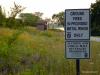
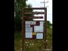
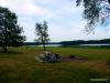
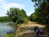
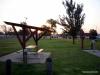
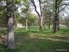
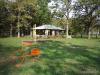
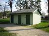
This is a collection of bicycling photographs from the state of Kansas, published during the year 2012. Click on individual thumbnail images to view full-sized photos.